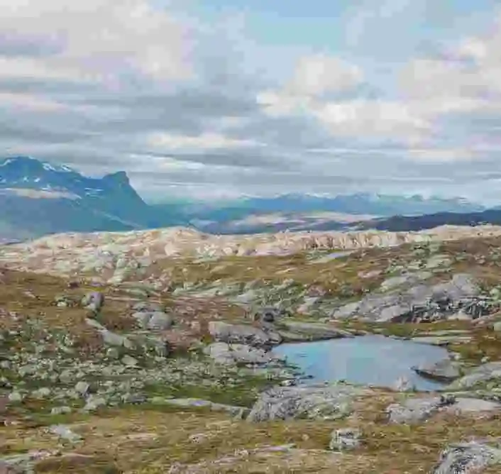
Cycling in Riksgränsen offers high mountains, rippling streams, and winding dirt roads. The warmth of the sun and the fresh mountain air feels serene as you pedal up mountains, down trails, and along alpine lakes. After climbing across mountain heaths, you’re rewarded with sweeping views of the Norwegian-Swedish mountains – a reminder of nature’s grandeur at the border between Sweden and Norway. Whether you’re seeking adrenaline-fueled adventure or peaceful breaks beside clear mountain creeks, the area inspires a strong sense of freedom and connection to the Arctic landscape. Mountain biking in Riksgränsen suits both seasoned riders and beginners, with a range of trails and unforgettable views.
EXPLORE RIKSGRÄNSEN ON YOUR OWN
Dates: June 23 – September 14.
Things to keep in mind: Weather can change quickly – bring appropriate clothing (rain jacket, hat, gloves, extra layers), water bottle and something warm to drink, and snacks.
Good things to pack: First aid kit / Compass / Map of the area / Multitool & repair kit / Chain breaker / Spare tube / Bike pump.
Riksgränsen – Trollsjön – Björkliden
Distance: About 30 km.
Difficulty: Moderate to Advanced.
Time: 5-8 h.
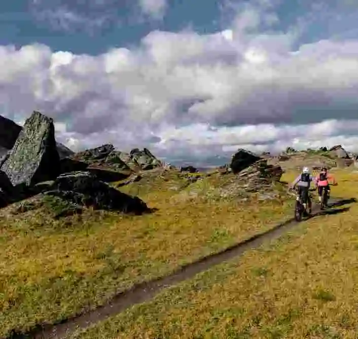
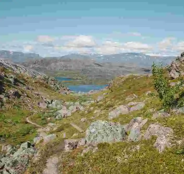
Terrain: Mountain trail, boulders, bridges, heathland, short sections where you’ll need to walk the bike.
This tour is for those looking for a full day in varied terrain, with both physical challenges, relaxing sections, and some of Sweden’s most stunning views.
From Riksgränsen, you head east along the E10 for a few kilometers until you reach the parking lot at Kärkevagge – the valley known as “Stendalen” (Stone Valley) for its dramatic rock formations. There, you follow a trail that gradually ascends through the valley, flanked by towering cliffs, rushing creeks, and massive boulders. After about 5–6 km, the trail gets rockier and more technical – some parts require walking the bike, especially as you approach Trollsjön. When you finally reach the lake, you’re greeted by mirror-still, turquoise waters (with visibility down to nearly 30 meters), surrounded by snow-capped peaks in the heart of Lapland’s wilderness. The sense of peace here must be experienced. Ending in Björkliden opens up the chance for a cozy dinner at Lapporten Restaurant with the option to continue to Låktatjåkko Mountain Station the next day.
Riksgränsen – Rombaksbotn
Distance: About 20 km one way.
Difficulty: Moderate.
Time: 3–5 hours (one way with breaks and photo stops).
Terrain: Gravel road, technical trail, boardwalks, rocky sections.
Love mountain biking, adventure, and history? Then this is the perfect route for you.
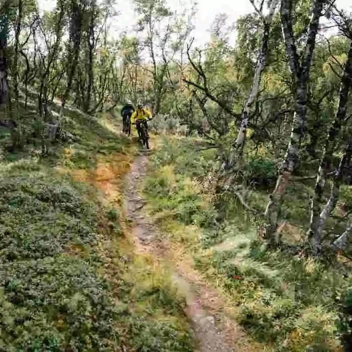
Starting in the mountain landscape of Riksgränsen, you follow Rallarveien – the historic transport route built during the construction of the Iron Ore Line in the early 1900s. This spectacular trail gradually descends through valleys, past waterfalls, old building remnants, and narrow passages. The trail traverses open mountain heath, rugged rockscapes, and eventually forested areas closer to the fjord. Along the way, you’ll enjoy breathtaking views of the mountains, rivers, and valleys – and further down, the vistas open up over the Rombaksfjord and Rombaksbotn (psst – there are still WWII shipwrecks out in the bay). Adventurous riders can end the ride with a refreshing swim. We recommend booking a train back to Riksgränsen from Bjørnfjell Station (about 12 km cycling uphill, 2–3 hours) or arranging boat transport from Rombaksbotn to Narvik and returning by train from there.
Off-trail and freeriding
Around Riksgränsen lies the perfect playground for those who want to leave the trails behind and carve their own lines among boulders, steep slopes, and mountain heath. Already on the north side of Låktafjället, above Björkliden, you’ll find unofficial descents where grass, gravel, and solid rock mix with natural ledges and drops. Here, with Lake Torneträsk shimmering below, you’ll need solid braking technique and good suspension handling to fully enjoy the steep, open lines. Other advanced options include the area around Kärkevagge or the Kuokkeltoppen ridge toward Norway. Around Kuokkeltoppen, there are no marked trails at all – only rocky ridgelines and snowfields that may linger well into summer. Only the most experienced riders should tackle the narrow, exposed lines, but the reward is top tier: a panoramic view of Lapporten, Abisko, and the Narvik fjord rarely seen from the saddle.
Wherever you choose to ride, the right gear is essential: a stable full-suspension MTB or a hardtail with solid front suspension, full-face helmet, back protector, and knee and elbow pads. Your pack should include a multitool, chain breaker with spare links, pump, tube, first aid kit, and wind- and waterproof clothing. A phone in a waterproof case – or even better, a satellite communicator – adds peace of mind in case of emergency.
Respect for nature is just as important as riding technique. Stick to durable surfaces to minimize erosion, take your trash with you, and stay aware of wildlife and any bird protection zones – especially inside Abisko National Park, where special rules apply. Ride freely, but with care for the environment and all the mountain’s inhabitants.